The 2013 version of the Gazetteer was updated in 2018 to a new platform, giving it more geographical reach, and in 2019 the Board improved its accessibility. Upgrades are ongoing, and although there’s still room for improvement, the tool is proving to be more versatile and user-friendly every year.
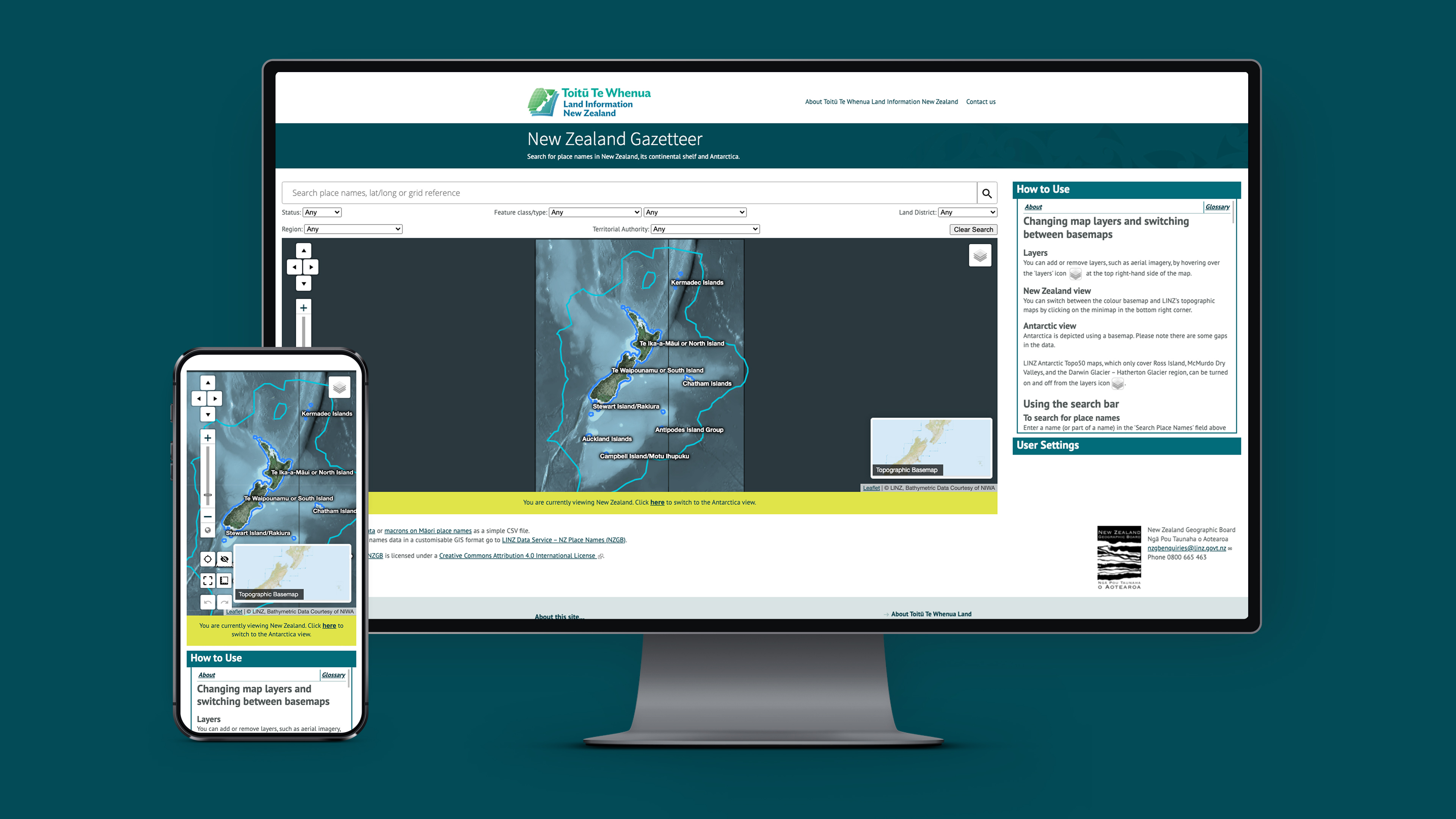
“It’s come a long way,” says Wendy Shaw, Secretary of the New Zealand Geographic Board. “There’s a huge amount of extra functionality. There are now user settings that you can switch on and off; you can look at Antarctica, undersea, and right out to the limits of the continental shelf up to 12 nautical miles. The search feature drops down matches and shows you locations as you hover over search results — there are so many spatial connections.”
The Gazetteer isn’t a high-use site, but it’s over-delivering on the Board’s obligations and simultaneously growing its reach.
“Our most recent stats show that users were up 56 per cent year-on-year, with new users up 58 per cent, and our data layers are getting more traction, too,” says Wendy. “We don’t get a huge amount of traffic, but whenever we’ve spoken to people about the Gazetteer they’ve thought it was really useful.”
The Gazetteer will continue to be tweaked and upgraded over time to provide Kiwis with more insights into the country's official — and unofficial — place names. The Datacom team has been working with the Board since the Gazetteer’s launch as a digital map, working to get the best possible results within a tight budget.
“The Datacom team has been pretty amazing to work with,” says Wendy. “We had a fixed timeframe and budget for the work, and they kept to our fixed amount.”
Wendy and the other three members of her team are hoping to improve the user-friendliness of the tool and extend its usefulness for students and historians.
“We’d like to add audio for pronunciation, and photos of places and features,” says Wendy. “We also plan to add more stories — there are 53,000 place names but only 15,000 have information about their meaning or history. In the future we plan to populate every single place name with its story.”